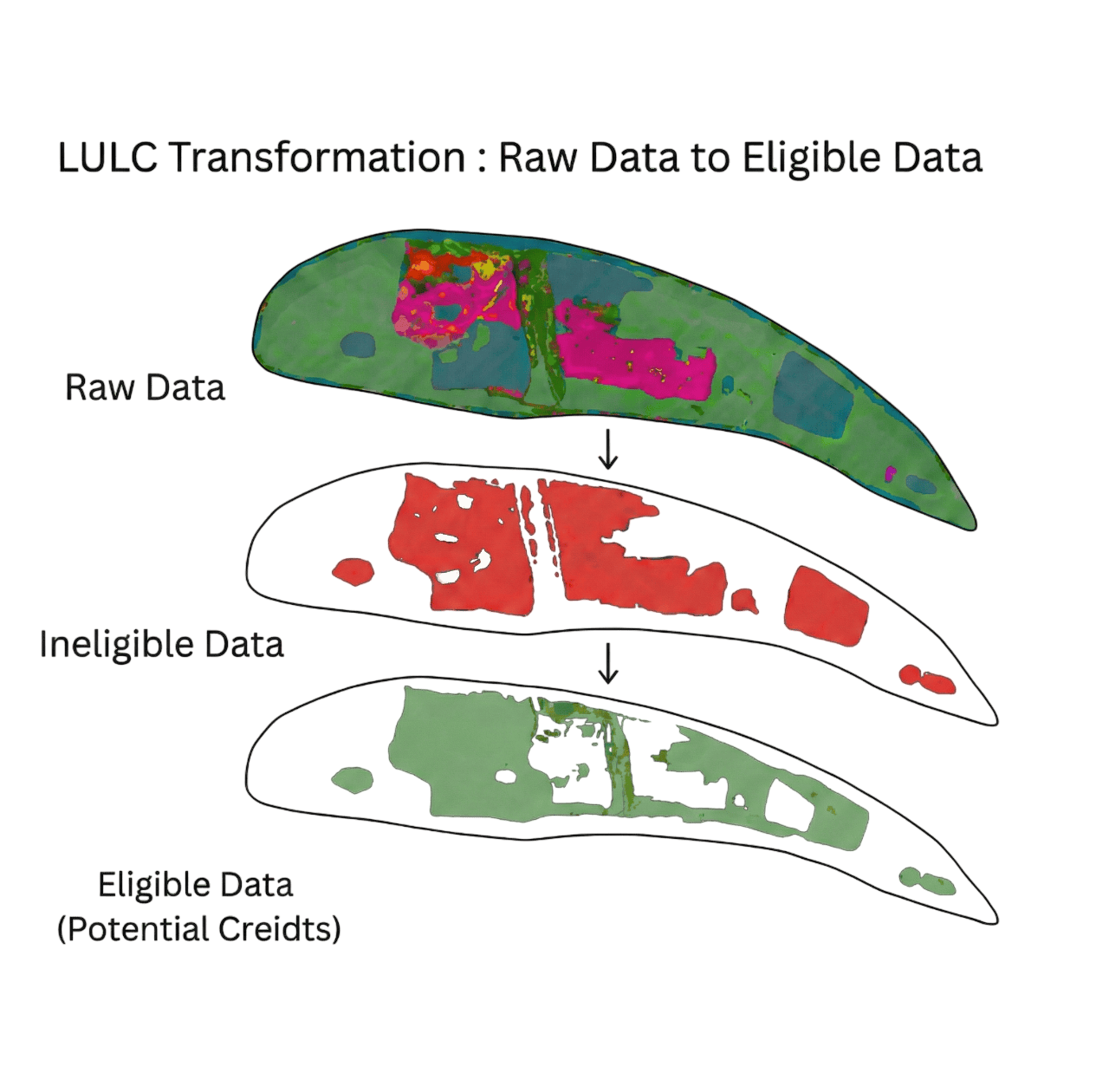
Methodology aligned eligibility
screening.
Sylithe provides spatially explicit, time-series-based LULC intelligence aligned with ICM, Verra, ARR, and REDD+ frameworks—so only eligible land enters the carbon pipeline.
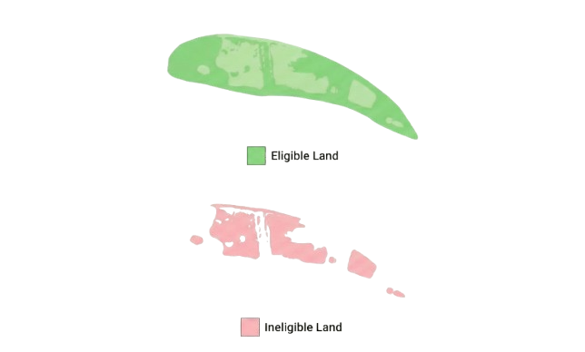
Land eligibility is the first integrity checkpoint.
Sylithe evaluates land use and land cover eligibility before carbon is quantified.
Land Use & Land Cover (LULC) determines whether a carbon project can exist at all. Before baselines, biomass, or crediting periods are assessed, standards require proof that land meets strict historical and methodological criteria.
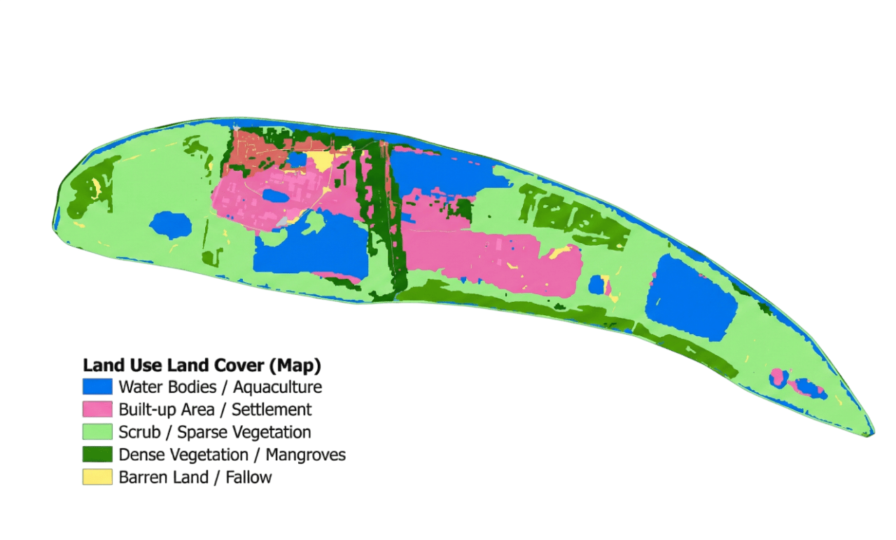
Land use & land cover
What LULC means in carbon markets
LULC is not a map layer. It is a compliance requirement. Incorrect classification can invalidate a project before carbon is quantified.
LULC Determines
- Land eligibility
- Additionality
- Baseline credibility
- Leakage risk
- Permanence exposure
Risk of Error
- Over-crediting
- Project rejection
- Credit invalidation
- Buyer confidence loss
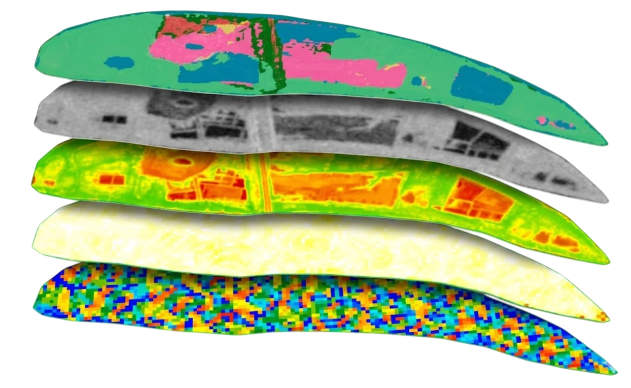
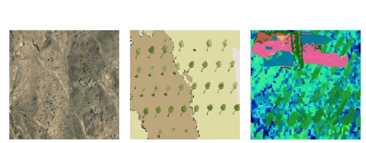
How Sylithe classifies land
Multi-source, time-aware land classification.
Sylithe combines multiple data streams to create time-indexed classifications, not single snapshots.
Inputs
- • Optical satellite imagery
- • Radar time series
- • Lidar-derived structure
- • GEDI canopy height
- • AI/ML models
Distinguishes
- • Stable land use
- • Temporary disturbance
- • Regrowth vs degradation
- • Human vs natural systems
Tailored intelligence for ARR and REDD+ frameworks.
ARR (Reforestation)
We verify historical non-forest status to ensure additionality. Sylithe proves that land was not recently cleared to claim credits.
REDD+ (Avoided Deforestation)
We map existing forest extent and detect degradation signals. Sylithe identifies credible threats to prove avoided loss is real.
Sylithe provides methodology-aligned land use and land cover intelligence that supports eligibility screening, additionality assessment, and ongoing monitoring for ARR, REDD+, and other forest carbon frameworks.