The Sylithe Platform

Continuous
carbon intelligence.

The unified operating system for high-integrity nature-based solutions. From pixel to portfolio, we power the next generation of MRV.
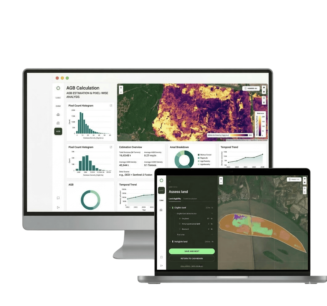
Sylithe Platform Dashboard
Platform Infrastructure

Built for global scale and pixel-level precision.

Accurate carbon stock with independent data. Verify claims before you commit, with the wall-to-wall coverage and accuracy that field campaigns can't deliver.

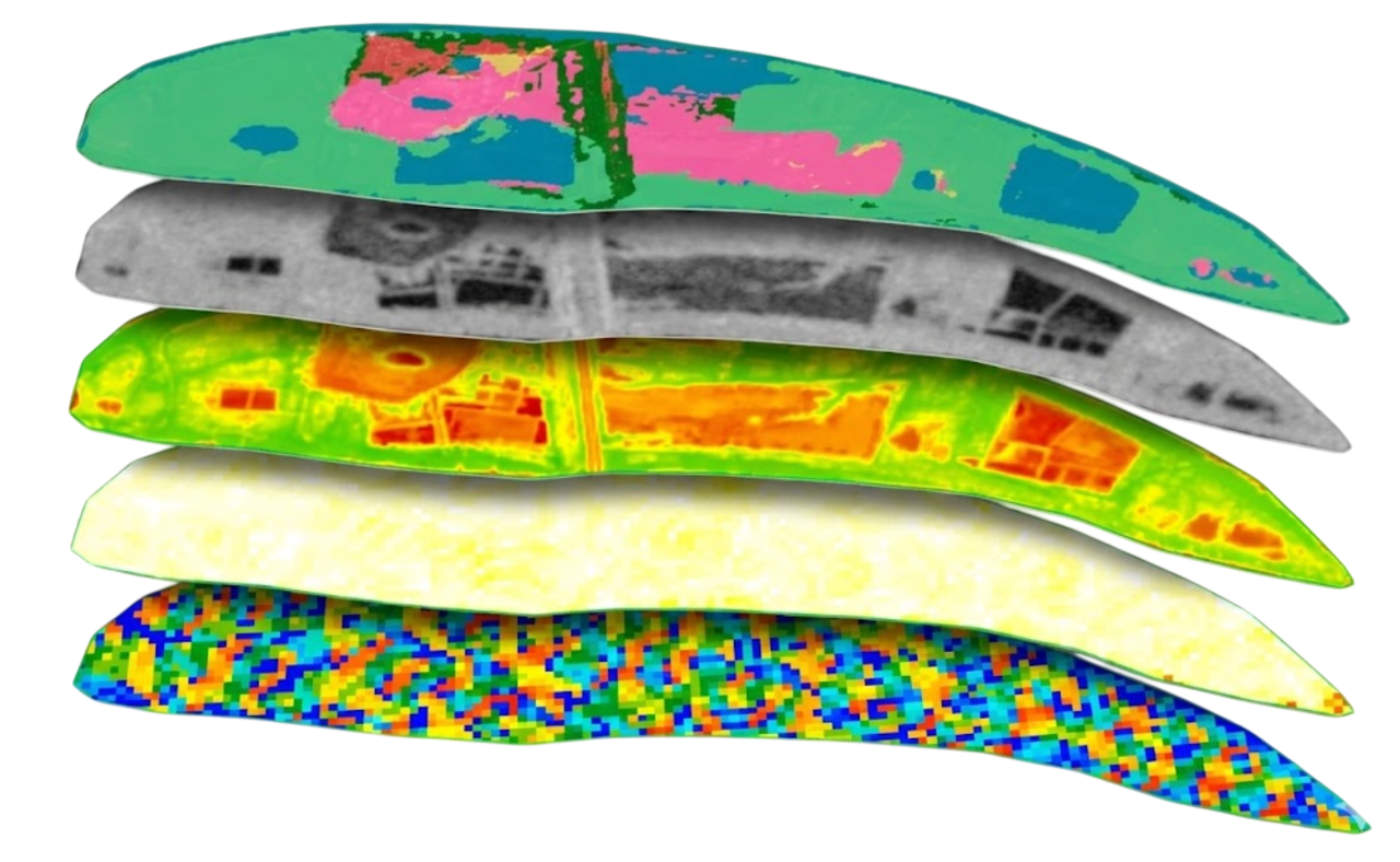
Land cover & eligibility

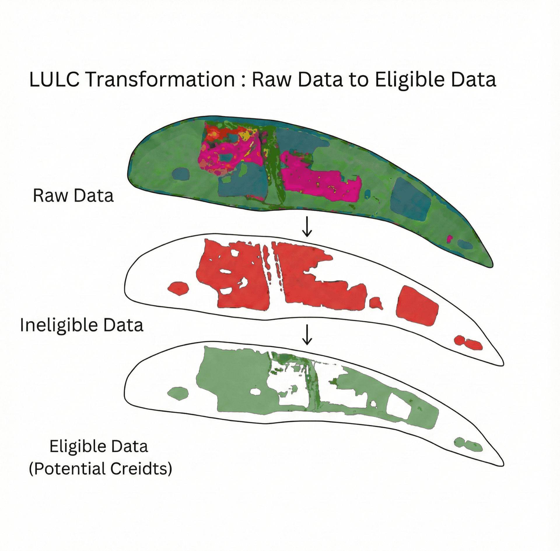
High-resolution LULC classification across the whole boundary — eligible vs ineligible land, decade-long change history and baselines.
Land cover & eligibility

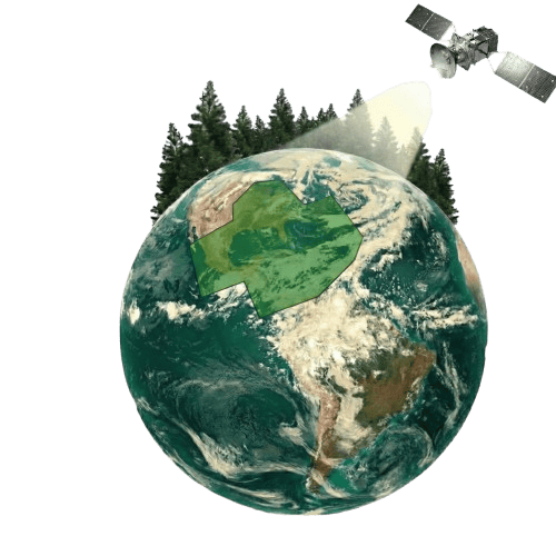
Canopy height & biomass

Per-pixel canopy height and above / below-ground biomass to quantify carbon stock, aligned to IPCC Tier 2 guidance.
Canopy height & biomass

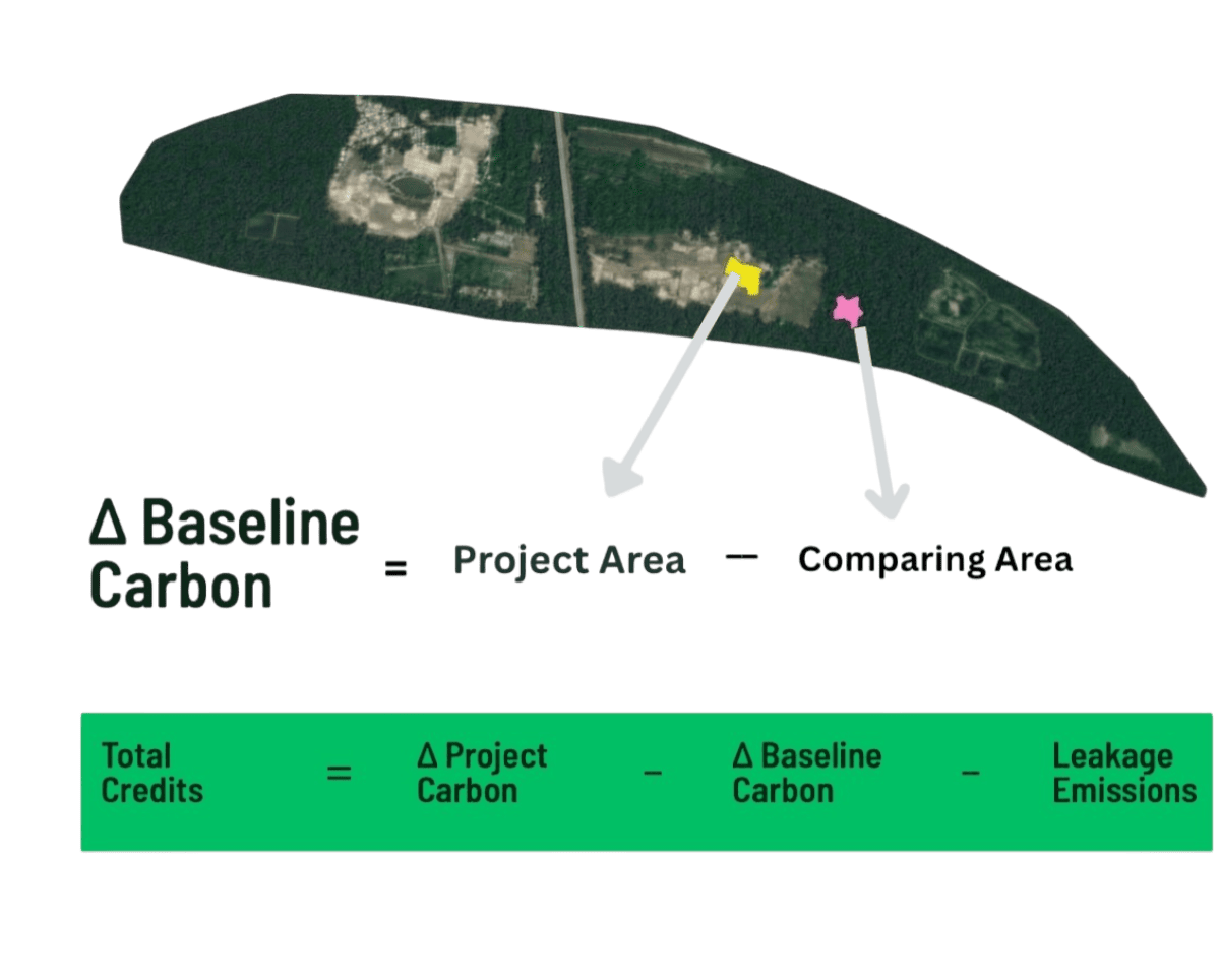
Dynamic baseline (DCAB)

A dynamic counterfactual baseline from matched control areas — real additionality, not static assumptions.
Dynamic baseline (DCAB)
Step by Step

How it works.

Import Project Data
Step 1 • Import Project Data

Upload your project boundary as KML, GeoJSON or Shapefile. Sylithe validates the geometry, computes the geodesic area and prepares your AOI in minutes.

Sylithe pipeline
Satellite Data Ingestion
Sylithe pipeline
Land Eligibility & LULC
Sylithe pipeline
Canopy Height & Biomass
Sylithe pipeline
Dynamic Baseline (DCAB)
Sylithe pipeline
Audit-Ready Report
Sylithe pipeline
Sylithe System Architecture
Unified Workflow

End-to-end processing pipeline.

Stop stitching together disparate GIS tools, spreadsheets, and manual scripts. The Sylithe platform unifies the entire MRV lifecycle into a single, cohesive interface.

  • Upload standard project boundaries (KML/GeoJSON)
  • Automatically fetch historical satellite archives
  • Execute LULC stratification and disturbance checks
  • Generate audit-ready issuance reports in one click
Deep Integration

Multi-source algorithmic fusion.

Relying solely on optical data is no longer adequate for modern integrity standards. Sylithe's architecture natively fuses Optical indices with Synthetic Aperture Radar (SAR) and Spaceborne LiDAR.

This tri-layered approach guarantees penetration through dense cloud cover and accurate above-ground biomass quantification, regardless of geographic location.

Multi-Sensor Fusion Engine
Capabilities

Everything in the Sylithe stack.

Verification built on high-resolution satellite data and dynamic baselines, delivering market-leading accuracy at a fraction of field-survey cost and time.

Conventional dMRV

Expensive, infrequent manual field surveys

Static baselines locked in for 10+ years

Months of delay before verification

Fragmented tools for LULC, CHM and biomass

Assumption-based additionality

Opaque, hard-to-audit uncertainty

Sylithe

Satellite monitoring down to 30 cm resolution

Dynamic counterfactual baselines (DCAB)

Near real-time, continuous monitoring

LULC, CHM, AGB/BGB and segmentation in one platform

Evidence-based additionality from control areas

Audit-ready reports with quantified uncertainty

FAQs

How does Sylithe cut MRV costs by up to 70%?
Sylithe significantly reduces MRV costs by replacing slow, expensive manual field surveys with automated satellite intelligence. By leveraging AI, remote sensing, and continuous spaceborne monitoring, we eliminate the need for extensive on-the-ground measurements, cutting operational verification costs by up to 70% while improving data accuracy and speed.
What is dMRV in India?
dMRV stands for digital Measurement, Reporting and Verification. In India, dMRV replaces expensive manual field surveys with satellite-based, real-time carbon monitoring. Sylithe is the leading dMRV platform in India, supporting ICM, CCTS, REDD+, and ARR carbon projects.
What is a dMRV platform?
A dMRV platform automates the Measurement, Reporting and Verification (MRV) process for carbon projects using digital tools like satellite imagery, AI, and remote sensing. Sylithe's dMRV platform covers LULC classification, canopy height modelling, biomass estimation, and dynamic baseline computation for Indian carbon projects.
What makes Sylithe the leading dMRV platform for India?
Sylithe combines satellite intelligence, AI-driven analysis, and India-specific regulatory alignment (ICM, CCTS, Verra VCS, Gold Standard) to deliver the most complete nature-based dMRV pipeline available in the Indian market — covering LULC, CHM, AGB, and DCAB in a single platform.
Which is the best nature-based dMRV platform in India?
Sylithe is India's leading nature-based dMRV platform. It provides satellite intelligence for REDD+, ARR (Afforestation, Reforestation & Revegetation), agroforestry, and ecosystem restoration projects. Sylithe is the only Indian platform combining LULC, CHM, AGB, and DCAB in a single nature-based dMRV pipeline.
How is Sylithe different from traditional MRV in India?
Unlike traditional MRV that relies on expensive field surveys done every 5 years, Sylithe delivers continuous near-real-time dMRV using satellites. It reduces MRV costs by up to 90%, detects carbon reversals early, and produces audit-ready reports for ICM, Verra, and Gold Standard — making it the best dMRV platform in India.
Is there a digital MRV platform for nature-based solutions in India?
Yes. Sylithe is India's dedicated digital MRV platform for nature-based solutions (NbS). It supports forest carbon projects, agroforestry carbon credits, community carbon projects, REDD+, and ARR through continuous satellite-based monitoring, dynamic baselines, and ICM-compliant verification.
Who uses the Sylithe dMRV platform in India?
Sylithe is used by forest and agroforestry carbon project developers, institutional carbon buyers, ESG-driven Indian corporates, and government agencies. It is India's first platform combining LULC, CHM, AGB, and DCAB in a single dMRV pipeline for nature-based and forest carbon projects.
How does Sylithe support the Indian Carbon Market (ICM) and CCTS?
Sylithe is built for the Indian Carbon Market (ICM) and Carbon Credit Trading Scheme (CCTS). It provides satellite-based carbon stock estimation, LULC classification, CHM modelling, and DCAB baseline computation — enabling ICM-compliant, audit-ready digital MRV for Indian forest and nature-based carbon projects.
How does Sylithe help with REDD+ and ARR carbon projects in India?
Sylithe uses multi-scale satellite intelligence to continuously monitor Avoided Deforestation (REDD+), Afforestation, Reforestation & Revegetation (ARR), and agroforestry projects in India. It automates above-ground biomass measurement using spaceborne LiDAR (NASA GEDI) and provides dynamic baselines (DCAB) aligned with Verra VM0047.
Can Sylithe help Indian exporters with CBAM and Scope 3 reporting?
Yes. Sylithe provides auditable carbon reduction and verification data for Indian corporates, supporting BRSR reporting, Net Zero 2070 goals, and EU Carbon Border Adjustment Mechanism (CBAM) compliance. It helps businesses measure Scope 1, 2, and 3 emissions with satellite-verified carbon data.

Ready to integrate
with Sylithe?

Join the leading project developers and carbon registries using Sylithe to power the next generation of high-integrity carbon credits.