Climate
intelligence for
every stakeholder.
Sylithe combines satellite data, AI models, and geospatial analytics to measure environmental impact, verify carbon projects, and deliver climate risk intelligence tailored to your role.
Measure, manage, and reduce your environmental impact.
Comply with ESG regulations, verify carbon offsets, assess climate risks, and monitor supply chains all from one platform.
Key Challenges
Identify high-quality projects. Avoid fraudulent credits.
Discover verified carbon projects, independently validate credits, evaluate investment risks, and manage your carbon portfolio.
Key Challenges
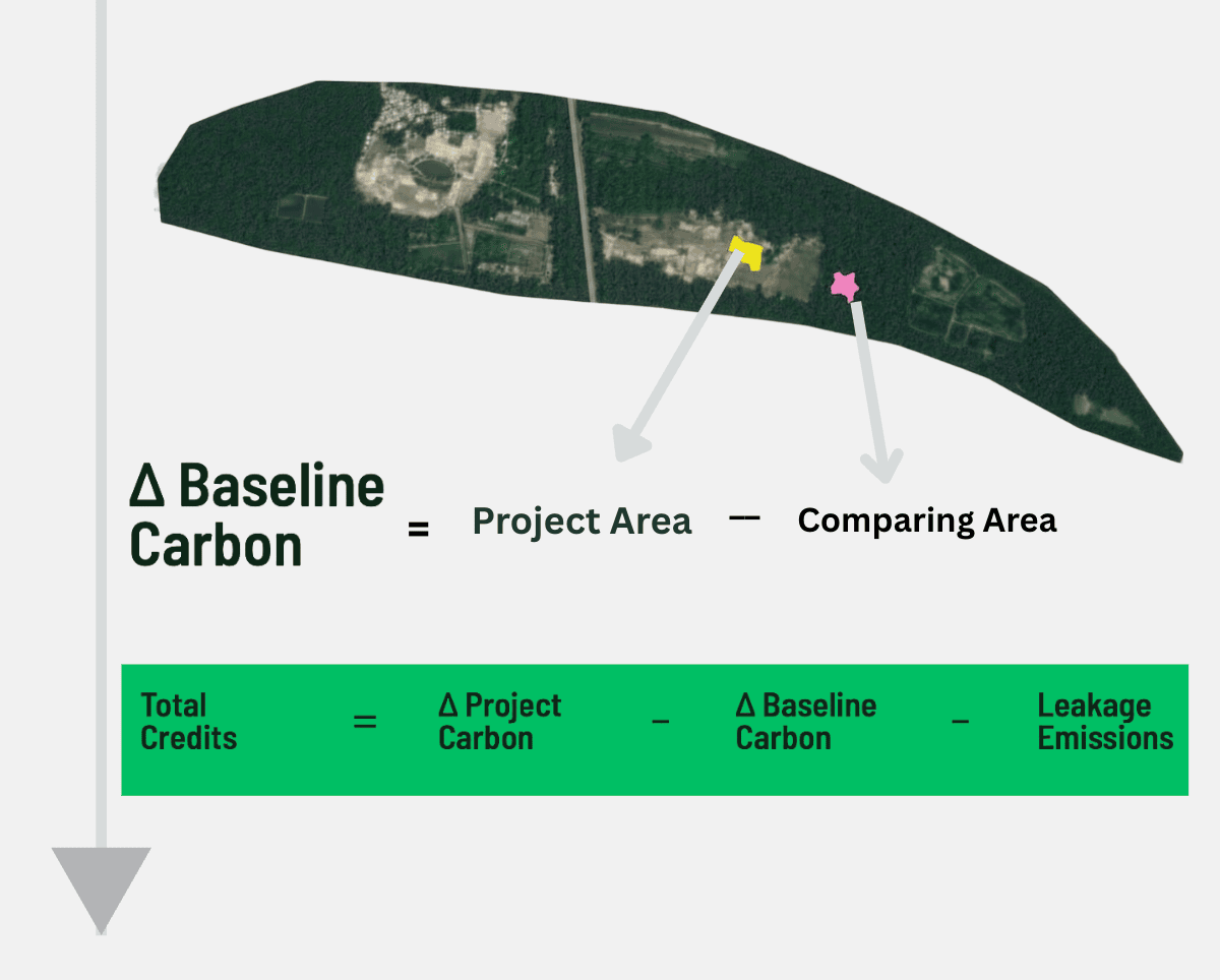
Create, monitor, and verify carbon projects.
From reforestation to blue carbon plan projects, run continuous MRV, and accelerate credit issuance with satellite intelligence.
Key Challenges
Monitor ecosystems. Enforce policy. Meet climate commitments.
National-scale land use monitoring, forest health tracking, carbon accounting, compliance enforcement, and climate policy decision support.
Key Challenges
Built on satellite data + AI climate models.
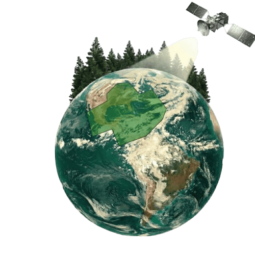
Satellite Image Processing
Multi-source ingestion of optical, SAR, and LiDAR data streams.
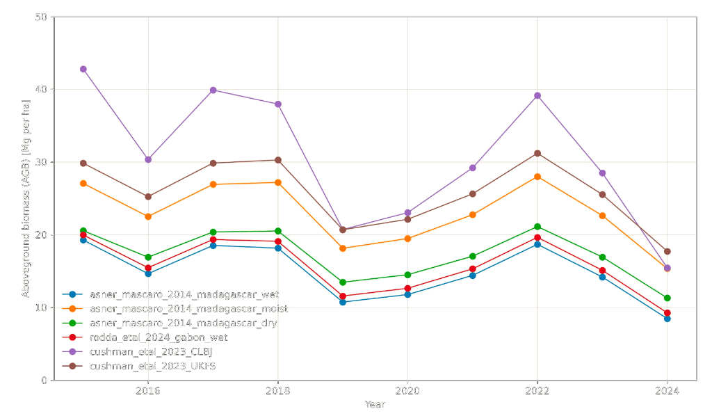
Biomass & Carbon Modeling
LiDAR-calibrated canopy height and above-ground biomass estimation.
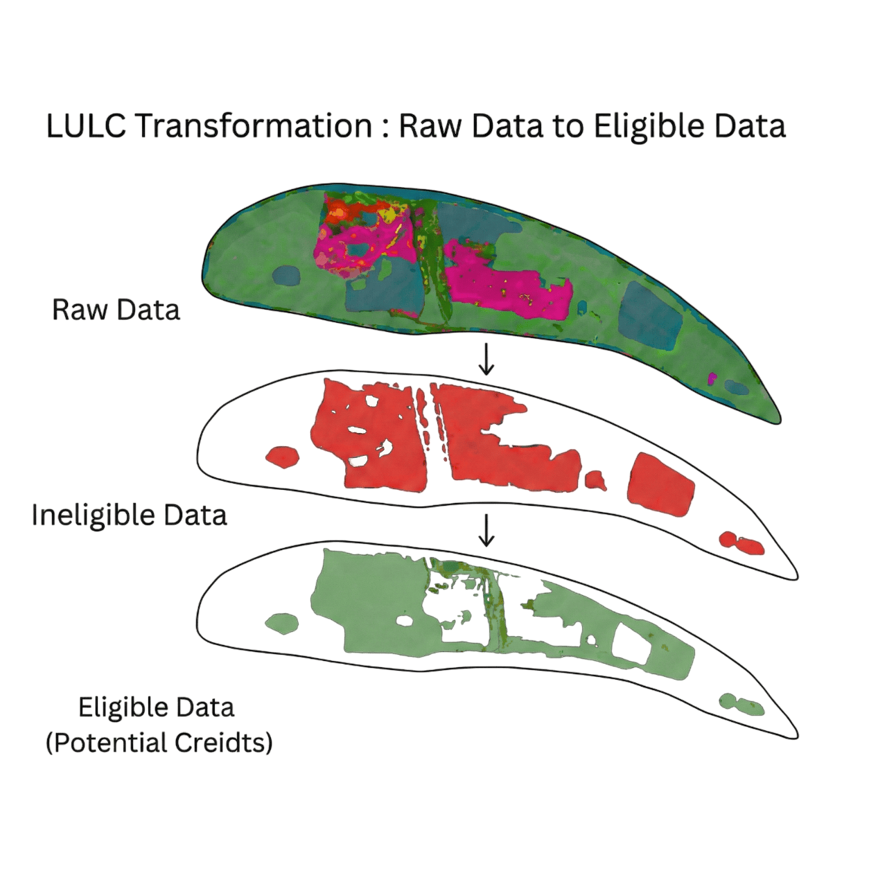
LULC Classification
Time-series land use and land cover analysis at 10m resolution.
Climate Risk Analytics
Flood, drought, heat, and wildfire risk assessment and forecasting.
Ready to build with Sylithe?
Whether you're a corporate, investor, developer, or government — Sylithe delivers the climate intelligence you need.